EOC Middle Final: GPS Analysis

Posted by Jan Kocbach, 17 May 2012@19:00

Many route choice options and varied orienteering – that is what met the competitors in today’s middle distance final in the European Championships in Skattugnbyn, Sweden.

This article is part of the EOC 2012 GPS-analysis series. In a cooperation with the EOC 2012organizers, World of O/O-training.net will do GPS-analysis after each of the EOC races in Sweden the coming week.

Men Start-1 / Women Start – 1

Men:

0001

Women:

w0001_s

To the first control the best choise was clearly to go left which as you see on the routechoice statistics for both the men and women above. This was also the coursesetter Eva Jurenikova’s jugdement ahead of the event. One of the main reasons for so many runners choosing the rightmost route, is that the hill was very steep – and it was tempting to go right. I was out as a test runner in the morning, and even if I knew that left was supposed to be faster, I choose the rightmost option due to the tough hill.

One interesting point here: Both the European champions Lundanes and Niggli chose a non-optimal route. Lundanes went right and lost a few seconds. Niggli went direct(!) through the big depression – loosing nearly half a minute to Minna Kauppi!

Men 2-3 / Women 2-3

leg2

Men:
0203

Women:
lundnes_kaas4

From 2 to 3 there were two main choices – either left saving some height or right using a path for part of the leg. The rightmost choice using the path was tempting for many as this reduces the technical difficulty of the leg somewhat. However, based on the routes run it looks like the majority of fast times are run on the left variant. You should, however, make the last half of the route as short as possible (many took a too wide curve).

Interestingly, Olav Lundanes took the “wrong” choice again – but run fast. All four top women took the left option.

Men 5-6 / Women 5-6

leg6

Men:
0506

Women:
w0506_s

The leg from 5 to 6 was the leg in the course which spread the runners most. However the different routechoices were very equal in running time. The course setters favourite was the northernmost choise – which Olav Lundanes choose. However the choice of Kratov (going south all the way on the road) was nearly just as fast.

Men 8-9

leg9

0809

lundnes_kaas3

The leg from 8 to 9 was the longest leg in the mens class. The terrain did not invite to long routechoice-legs with very distinct routes – the “challenge” on this leg is the very last part of the leg. The left alternative is about 70 meters shorter – but you need to take a lot of extra, steep height. In addition you get more tricky control-taking by going left.

Based on the routes run – and also the course setters advice ahead of the race – the rightmost option were you go around the green area on the northern edge is the fastest.

Women 9-10

w0910_s

The women’s 9-10 waas not really a routechoice leg – a straight route was the only viable option. Still – typically of a middle distance – many runners lost time on the long leg due to the change in orienteering technique necessary. This was increased by the change in terrain characteristics

Men 12-13

leg13

1213

12132

lundnes_kaas2

The men’s leg 12-13 was an interesting leg. As you can see above, the fastest times were run on straight variants (don’t trust the split times above as these are GPS split times). Lundanes took time on the others here – the other Top 4 runners spreading well on different route alternatives. The straight variants are 60 meters shorter with not much more ascent – does it is clearly too far to take e.g. Carl Waaler Kaas’s route around to the right.

Men 16-17 / Women 11-12

leg17

Men:
1617

Women:
w1112_s

The leg from 16-17 for the men and the similar leg 11-12 for the women each had two distinct route choice alternatives: Either going right and using the big road and running a bit longer – or going left and taking more height while running shorter.

For both the men and the women, the left option up and down the hill has been run faster – however there is a big spread in running times for this route choice whereas runners running the rightmost routechoice have more consistently run good times.  Based on this the rightmost choise around the road might very well be the best option.

Do more yourself

The above analysis is done in 2DRerun – and all the GPS material is available there for you to do more analysis:

EOC Middle Qual: GPS analysis

Posted by Jan Kocbach, 14 May 2012@14:15

helena_tove2
The Middle Qualification opened the European Championships today – with all women runners carrying a GPS. Here you find a quick GPS analysis of the race. As this was a qualification race, focus is more on where the race was lost than on where it was won!

This article is part of the EOC 2012 GPS-analysis series. In a cooperation with the EOC 2012 organizers, World of O/O-training.net will do GPS-analysis after each of the EOC races in Sweden the coming week.

Jansson versus Alexandersson

The above illustration compares the routes of  two of the big profiles of this Europan Championships – Swedish Helena Jansson and Tove Alexandersson – finishing 1st and 2nd in Heat 3. As you can see (check out Jansson versus Alexandersson in 2DRerun for yourself to go further in the analysis), the main difference in this second part of the course seems to be running speed in the tougher parts of the terrain (yellow) and the last uphill.

See also:

Looks easy – can be tricky

bagstevold

The courses look seemingly easy when looking at them at the map, but still there were lots of mistakes made – mostly direction mistakes as you can see in the GPS-tracking from the women. A combination of running speed and good direction were the key ingredients to get to the finals. And of course accurate orienteering in the green areas.

One runner who had some problems in the start of the race was Norway’s Heidi Bagstevold. As you see on the illustration above, 45 degrees off already to the first control lost her more than half a minute. A bad compass direction to number 3 cost another 20 seconds – and then the big 3-minute mistake at number 6.  Happy ending for Bagstevold, though: She managed to keep the speed and secure her orienteering on the rest of the course, and made it to the A-final.

Direction

routechoicespreading

Looking at the spreading of routes on this leg from control 7 to control 8, it is obvious that straight is fastes (green color = fast). Looks like some might need to practice a bit more compass running before the A- and B-finals?

Although direct was faster in almost all legs today – there is no rule without exception. On the leg to number 11 (see below) it seems like the road option to the left is slightly faster. The reason for this is the tough terrain direct.

aroundfaster

EOC 2012 GPS analysis: Warm up with training-analysis

Posted by Jan Kocbach, 10 May 2012@8:00

In a cooperation with the EOC 2012 organizers, World of O/O-training.net will do GPS-analysis after each of the EOC races in Sweden the coming week. As a warm-up I have taken a brief look at some of the trainings in EOC-relevant terrain which have been uploaded to 3DRerun/2DRerun.

As running speed and focus has been different for the different runners, this analysis will more look at some examples from different EOC training maps than to look at a specific analysis. Still it can be good to take a look to see what kind of challenges the runners will meet in Sweden next week. You can also take a look at what the course setters say about the terrain and the challenges at the EOC webpage. - Those that ran pre-EOC and Elitserien at Bonäs in spring 2011 may be expecting similar, extremely fast pine heath terrain with sandy ridges. Sure, there are similarities with Bonäsheden but the terrain in Skattungbyn is more varied, many of the ridges are higher, the depressions deeper and the amount of detail greater.

Sample 1 (a): Run straight lines

This sample is from a one-man relay training at Åmotjärn 2. Typical for this terrain is many small hills with some some open forest, some greener areas and some marshes. In many cases the fastest route is to stay as close to the line as possible – and in this example you can see how staying close to the line usually gives you an advantage of some seconds compared to making curves out.  Open sample in 2DRerun.

sample1b

Sample 1 (b): Direction mistake – underestimating difficulties

Control number 20 above is one control were many runners did a direction mistakes. It is actually a quite easy control if you pay attention to direction and contours (to the left of the line) and the big path (the small path might be tricky to see?). The big path just ahead of the control makes you think the control is very easy – that is probably a reason for the many mistakes here. Open in 2DRerun.

sample1

Sample 2: Run straight lines II

The second sample is from an EOC training on the map Vika. Compass and running straight is again important in this second example, even if the terrain characteristics are quite different. The example clearly again shows how all the small detours you take away from the line costs you a few seconds here and a few seconds there.  The straight route choice is by no means the best choice for all legs in the EOC terrain – but in the cases where it is, you should use your compass and run straight. Open sample in 2DRerun here to take a closer look at it.

However: Don’t get fooled by the examples above – there may also be legs in this terrain-type where routechoices will be decisive! Both micro-routechoices and longer routechoices – so the straight line is not always the best approach – however make sure that you can run straight wherever it is necessary.

sample2

Sample 3: Speed adaption training, Gesunda

The third example is a speed adaption training in Gesunda – on a snowy day which you can read about on Gustav Bergman’s Doma-archive (Kerschbaumer was there the same day). Two of the worlds best orienteers who are among the favorites at the upcoming EOC  - a bad day for both of them – they hopefully learned a lot before returning to the Falun-area next week!  - A legendary bad performance. I don’t know what I shall say, is Bergman’s comment on his Doma-archive. The snow surely did not improve the concentration, but you should not fall asleep mentally on the long legs in this terrain. Also for the legs down the hills the tactics should be put on making the control easy to find. See example in 2DRerun here.

sample3

Excellent presentation about O-technical analysis (Norwegian)

Posted by Jan Kocbach, 09 May 2012@5:00

otekniskanalyse
As a part of the Norwegian program for educating trainers within orienteering (the Trainer 2 course), Sindre Haverstad has made a nice presentation about “O-technical analysis” for trainers. It is in Norwegian, but there are many illustrations, so you will get the idea also without being fluent in Norwegian.

The presentation looks into different types of analysis a trainer – but also an athlete – can use for analysis of orienteering technical training. The content goes from traditional techniques like conversations with the athlete/split times to modern analysis like GPS-analysis with 2DRerun and HeadCam analysis with 3DRerun or Camolyze.

The presentation is highly recommended.

Camolyze Review: HeadCam analysis software

Posted by Jan Kocbach, 29 Apr 2012@16:00

camolyze_s

Camolyze is a dedicated tool for HeadCam analysis of orienteering races and training for Windows computers. While other tools available either require Internet access (3DRerun, Attackpoint HeadCam analysis tool) or hours of data crunching (RGMapvideo), Camolyze can be used on your local computer without internet connection – for example at a training camp.

This article demonstrates how you can use Camolyze for analyzing HeadCam videos synchronized with your GPS through a screencast.

Demo video – from A to Z

Below you see a demonstration video which shows how you get your training or event into Camolyze. The video goes through all steps required ; adjusting the route in QuickRoute, exporting map and route files, and opening video, map and route in Camolyze.

Review

Camolyze is still rough around the edges with some bugs and some missing error messages, but after you have used it one time or two you should be able to prepare an analysis in around 5 minutes after transferring the video file to your computer.

Camolyze has the main features you need in order to do a good analysis of your race. Map and video is synchronized – and thus you can easily get to any position in the course to look at a specific mistake. There are also possibilities to tag certain parts of the course to easily find back to key places in your race/training.

Compared to the 3DRerun, Camolyze can be used offline and is therefore a clear winner if you are on a training camp without Internet connection. If you have an Internet connection – Camolyze and 3DRerun each have their advantages.

Installation

Do the following to install Camolyze (Note that Camolyze currently only works on Windows):

  • Download Camolyze from the Camolyze webpage, unzip the file in some directory, and run the exe-file.
  • You also need QuickRoute to utilize Camolyze.
  • To play GoPro videos, I had to install extra codecs on my Windows 7 PC. I installed the following:K-lite codec pack. Installation: Download and run the exe-file. Note that installing codecs like this might break other codecs, so be careful with what you do…
Known Bugs/Issues

I have not used Camolyze extensively, but have still noticed some bugs and/or issues:

  • If your computer does not have the video codecs required, the video will not play – but no error message is given. This can be quite confusing for new users.
  • If the correct fields are missing in the xml-file exported from QuickRoute, or if there is something wrong with your map image, you get no warning messages – it just doesn’t work.
  • The video offset is saved when saving a video, but it is not applied when loading. Thus you must re-apply the offset after loading a video.
  • It may take 15-20 seconds to open a new video/map – be patient!

If you have used Camolyze, please tell about your experiences in the comments below.

Training Camp Time: Video-intro to 2DRerun!

Posted by Jan Kocbach, 23 Feb 2012@5:00

Portugal, Spain, Turkey, Italy – most elite orienteers go south to training camps at this time of the year. Quite a few use 2DRerun for GPS-analysis at the training camps. As I get a lot of request about how to use 2DRerun, I made a 13 minute screencast which walks you through the basics.

Even if the screencast is made without preparations, I think you will be set to start using 2DRerun for analysis at your training camp after watching the screencast. Please watch in HD-quality and full-screen to see all details. Uploading of map and routes is handled in different screencasts which have been online for a long time already – you do that through the usual 3DRerun interface. See also some further tips below the video.

Tips
  • Remember to use only 2 points for calibration if you use QuickRoute for calibration.
  • If you use Doma as map archive, you are encouraged to upload your maps to your doma-archive, and use the new on-demand upload to 3DRerun from Doma functionality (so that I don’t have to use up my server for the map files).
  • An added benefit if you use the new Doma version 3 is that you automagically get the blank map as background map in 3DRerun (even if you upload to your Doma with a non-transparent route).

2drerun

New version of QuickRoute and DOMA!

Posted by Jan Kocbach, 28 Dec 2011@5:00
qr

Two of the most popular free orienteering software available – QuickRoute and DOMA – are now updated to version 2.4 and 3.02, respectively. All QuickRoute users should consider an update – the new features are a big plus in daily use of QuickRoute. Update of DOMA is somewhat more involved, but absolutely a worthy upgrade.

QuickRoute 2.4

QuickRoute is the state-of-the-art tool for GPS-analysis of single GPS-tracks today – used by thousands of orienteers. See a full description of how to use QuickRoute for GPS-analysis here. The new version has the following improvements:

  • Map images can be scaled, rotated and cropped when creating new documents.
  • Route lines can be coloured according to two properties, for example both pace and heart rate.
  • Thick lines supported while adjusting maps (this alone is worth the upgrade!)
  • Support for the Garmin .fit file format.
  • Import of Hearth rate data from Garmin HR files
  • Improved integration with the new 3.0.2 version of DOMA (see below for info) – e.g. uploading of maps without route and with route.
  • QuickRoute is now available in a number of new languages.
  • Lots of other enhancements and bug fixes.

Download the new version here:

DOMA 3.02

DOMA is a digital orienteering map archive, to be installed on a PHP+MySQL-equipped web server. The digital orienteering map archive helps you display your and your friends’ orienteering maps and route choices on the web. Since the first version was released in the end of 2008, DOMA has been installed on over 700 web servers, where 2 000 users have added more than 40 000 maps. You find nearly 30.000 of these DOMA maps in the DOMA section of omaps.worldofo.com along with a lot of other orienteering maps. If your DOMA-site is missing in omaps.worldofo.com, please send a note about it to jan@kocbach.net.

News in Doma 3.02:

  • Maps can be commented by visitors.
  • Added overview map feature where the geographical locations of the maps are shown.
  • Map images without routes can be uploaded along with map images including routes, so visitors can plan their own route choices without actually revealing them.
  • Maps may be hidden for others than the owner until a certain time.
  • KML export, making it possible to open maps in Google Earth.

Download the new version from here:

Theoretical O-exercise: Follow the camera

Posted by Jan Kocbach, 15 Dec 2011@10:00

You have the map with start triangle marked on it. Then you have 3 videos. Your task is to correctly mark the position of Control number 1, Control number 2 and Control number 3. Can you manage?

In cooperation with OOCup we are able to deliver this nice theoretical O-exercise from Slovenian forests. If you have more time left after pondering over Route to Christmas, this is an excellent way of training your ability to understand the correspondence between map and terrain. The videos are of good quality (some of the best we have seen from orienteering in the forest), so it should not be as tiring to follow as some of the earlier similar o-technical challenges presented here at o-training.net.

Ultimate map

To make it a bit more tricky, the map shown is an “Ultimate map”, i.e. a map without paths as used in the special “Ultimate category” in OOCup. The rules are simple: Mark the 3 control points on the map, and submit your solution. OOCup even provides some prizes if you manage to find the correct solution AND are lucky: From all participants who send correct answers by December 31st, 4 prize winners are drawn, winning 1 transferable entry to OOcup, 1 transferable entry to Lipica Open, 1 OOcup T-shirt and 1 OOcup cap.

It is recommended to set the resolution from 360 to 720 in the videos for better details. Scroll down inside the video box to see videos number 2 and 3. Note! This isn’t easy – I had to watch the first video three times before I figured out where the control was…

Start to Control 1

Control 1 to Control 2

Control 2 to Control 3

Submit your solution below. Mark the control point with left click. Zoom in and Zoom out with + and – in upper left corner. Pan the enlarged map by holding the left mouse button. Delete the last point with the button under the map. Fill in the form and submit your solution!

About

Note that you find the same Theoretical o-technical exercise also at the OOCup webpage.

Have you got a similar theoretical o-technical exercise from your area? I’d be happy to put it up here on o-training.net if the video quality is good. If you’ve got some prizes, it is even better, but I’ll of course publish without prizes as well :)

Interesting new Orienteering Analysis Tools coming!

Posted by Jan Kocbach, 30 Nov 2011@5:00

Great times ahead for orienteers interested in analysis to improve their technique! Several new tools for orienteering technical analysis are being released in test-versions this autumn/winter: 2DRerun, Opath, otrax and Camolyze. In addition the most popular tool for o-technical analysis as of today – QuickRoute – is getting an update.

It surely looks like this is going to be very interesting months for those interested in improving their orienteering technique using computer tools!

This article only gives a brief introduction to each of the new tools – a more detailed review of the tools will be written when they are more “market-ripe”. For now they are in alpha/beta/test-version – however most of them are usable for analysis already. The developers are surely interested in your feedback in this phase – so please help them making even better analysis tools!

2DRerun

st

Introduction: 2DRerun is a complete rewrite of 3DRerun from the bottom. Instead of relying on the Google Earth plugin in 3D, a 2D representation is chosen based on feedback from elite runners. This works a lot better for analysis, you don’t need any special plugins installed in your browser, and it also works on the iPad/many mobile phones. Most of the functionality from 3DRerun is kept, and additionally the autOanalysis functionality is included. 2DRerun has now replaced 3DRerun as my personal tool for orienteering analysis as it is faster and a lot more efficient to work with than 3DRerun. All events which can be opened in 3DRerun can also be opened in 2DRerun.

Development state: 2DRerun is available as an alpha version, but is very usable in the Google Chrome (recommended) and Firefox browsers. Two workshops have been organized based on 2DRerun, and 2DRerun already has a large user base from several reigning World Champions to youth orienteers . 2DRerun does not work at all in Internet Explorer for now (support is planned in 2012). There is currently no documentation at all available for 2DRerun – but a  support and info-page for 2DRerun/3DRerun is available here. Planned development short/long term/very long term: Better competition management system under development, courses, groups, tagging, split-times, documentation, Internet Explorer support, direct upload from Garmin-watches, autOsplitsbrowser, improved of user interface, live-mode, several specific analysis-modes, Facebook-integration.

How to test drive: Here is a direct link to an autOanalysis comparing Thierry Gueorgiou and Daniel Hubmann in the World Cup middle distance in Czech Republic this autumn. In addition to viewing this autOanalysis and zooming by using the mousewheel or the +/- keys on the keyboard, you can change to “Replay mode” in the menu to the right and do many different types of analysis. To try this with other events, you can start 2DRerun when you view an event in 3DRerun by clicking “Try 2DRerun with these maps/routes” in the upper part of the right column. Alternatively, you can browse events/maps in the event overview, click the small “*” behind an event/map to get up all related events, and then choose “New: Open in 2DRerun” at the bottom of the page to open these in 2DRerun. You can also upload your own events after registering at the 3DRerun page.

O-trax

otrax

Introduction: The background for the development of otrax is that QuickRoute does not work on Mac – a “QuickRoute for Mac” was thus the starting point for the development. However, otrax is planned to be available also for Windows and Linux. otrax is described as “a GPS analysis tool of the next generation” which “takes the best out of existing tools and combines all into a single tool”.  otrax is planned to be a combination of a desktop application and a web application. As for 2DRerun/3DRerun, the program allows comparison of routes by different runners (e.g. through animations). As it is a desktop software, it will also work offline whereas 3DRerun/2DRerun needs an internet connection to work. The developers also state that one advantage of otrax is that you can get all the way from map+GPS-track to comparing of routes in a single program instead of mixing different tools to compare routes and publish routes in the Internet (e.g. combination of QuickRoute and 2DRrerun required today).

Development state: The first version of otrax was released for Mac/Linux at November 11th. This initial version is restricted to a subset of the features which are planned for later on, but according to the developers this initial version allows you to calibrate a GPS-track with a map, and more runners and compare routes for these runners. The developers tell that further development plans include 3D animations, groups, sharing over social media, a mobile site and more.  About the future, one of the developers Yannis Güdel states: - First otrax will conquer the Swiss Mac users. When the web application is available, many Windows users will start using otrax. otrax will not replace QuickRoute completely, but it is to be expected that  certain QuickRoute users will switch from QuickRoute to otrax.

How to test drive: otrax can be downloaded and installed from the otrax website. Note that currently there are only Mac/Linux-versions officially available. You can also download “an unstable windows version” to test the tool on Windows (I did test it, and you can test-drive the features, but you should probably wait for the stable version before you use this as part of your analysis flow).

Opath

Opath

Introduction: Opath is a new web-based orienteering analysis tool under development. In some respect Opath is similar to 2DRerun, but the focus for Opath is more towards analysis of competitions with several courses and split times available – although Opath will also be possible to use for simple trainings. Opath development was started in order to “fill the hole” which occured after RunOway was shut down and the user based was moved over to MapandCoach. The developer Mikael Eliasson describes it this way: OPath was started because many people missed RunOway. People seemed to like RunOway because it was very easy to  use, but still provided them with  what they needed. A goal for OPath is to make this even easier.

Thus Opath is focused on RunOway features in the start, e.g. import of courses and split times, drawing of routes for runners who did not use GPS, etc. However, another goal for OPath is to make it easy to upload trainings too. - It can be both club trainings and personal trainings with a few of your friends.  OPath also let you compare your tracks from different times, Eliasson explains. Some advantages of Opath seen from the developers view: A searchable database of events and courses, no requirements for any plugins like Java, Silverlight or Flash, direct upload from Garmin units, access to personal history, works without official split times.

Development state: An initial version is available on opath.se, but it must still be considered a test version. The webpage of opath.se states: - OPath has only existed a short time, the project was started in late october so there will be a lot of problems and a lot of features missing. Please be patient, we are trying the best we can to make the product awesome. Still, it is possible to test Opath, and get an impression about what it will give later on. Some improvements coming: Facebook login, support for competitions, your history, anonymous uploads, better privacy support, clubs and friends (make it easier to find courses).

Facebook login (as a complement to our login)
Support for OCAD files to upload courses(Done)
Support for competitions
Your history
Anonymous uploads
Better privacy support(Everybody can see your courses today)
Clubs and friends, make it easier to find courses

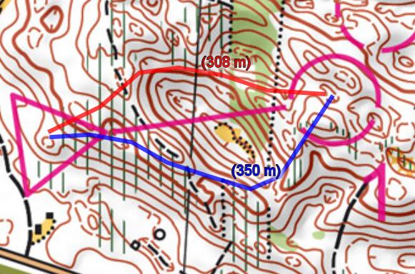
How to test drive: Go to opath.se to test the replay functionality. To upload new competitions/courses, you can get yourself an account at opath.se, and test those features as well. See an example of two trainings run 15 months apart compared here.

QuickRoute (update to version 2.4)

qr

Introduction: QuickRoute is the state-of-the-art tool for GPS-analysis of single GPS-tracks today – used by thousands of orienteers. See a full description of how to use QuickRoute for GPS-analysis here. The new version will get some improvement as described below. The most important improvement seen from my point of view is the ability to change the line width while adjusting the route. I have had several GPS workshops where QuickRoute has been used, and the inability to adjust the line width while adjusting the route has lead to a lot of unhappy faces (until they installed the development version which has this feature).

Development state: QuickRoute is stable and is currently available in version 2.3. Version 2.3 was released in March 2009, but there have been some development version available since which have introduced a few new features. The new stable version 2.4 is to be available quite soon. According to the developer Mats Troeng, the following improvements are in the pipeline for version 2.4: Possibility to change width of route while adjusting route, faster drawing of the route, support for mapreading analysis, new languages, import of HR-info from Garmin GPX-files and possibility to rotate/scale map while importing map.

How to test drive: Version 2.4 will be available on the QuickRoute download page soon. Information about the release will be published at WorldofO.com’s twitter account.

Camolyze

camolyze

Introduction: Camolyze is a new software for HeadCam analysis of orienteering races and competitions which is currently under development. Compared to existing tools for HeadCam analysis (e.g. 3DRerun or Attackpoint online tools as described here), the strength of Camolyze will be that it works on your local computer, and you will therefore not need an internet connection to use it. Camolyze will work directly with maps and routes exported from QuickRoute. This means that you should be up and going with analysis straight after your training, and that you can do analysis on your training camps in the wilderness.

Development state: There is still no version available for testing, but what I have seen from the developer looks very promising (there is a video of Camolyze in action available on the development page).

How to test drive: Not yet possible to test. See the development page of Camolyze for more information. I will write a review at o-training.net when I get access to a test version.

Existing tools

Other tools which have been covered briefly earlier and are not covered again here are listed below. All these tools require the organizer to upload map and other information about the event, contrary to the tools described above.

  • Map and coach – requires race organizer to upload information
  • Routegadget – requires race organizer to upload information
  • RunoWay (shut down – old maps/routes still available in archived version) – required race organizer to upload information

GPS autOanalysis SM Middle distance

Posted by Jan Kocbach, 17 Sep 2011@20:02

Victories to Jenny Johansson and Erik Rost in today’s SM middle distance – GPS-data makes it possible to see how the races where decided. Very tight in the mens class – Jonn Are Myhren was only a second behind. In the women’s class Johansson had more than a minute down to Helena Jansson in third.

Note that the times given below are from the the GPS data – thus not accurate to the second. Not much analysis is provided, but the illustrations give away some details – and there is of course also the full GPS tracking to watch.

Results A-finales
1 Erik Rost Malungs OK Skogsmårdarna 37:47 7:07
2 Jonn Are Myhren IFK Lidingös Skid o OK 37:48 +0:01 7:07
3 Emil Wingstedt Leksands OK 38:08 +0:21 7:11
4 Anders Holmberg Järla Orientering 38:12 +0:25 7:12
5 Zsolt Lenkei IFK Moras OK 38:15 +0:28 7:13
6 Graham Gristwood Södertälje-Nykvarn OF 38:20 +0:33 7:13
7 Oleksandr Kratov OK Orion 38:58 +1:11 7:21
8 Erik Axelsson Finspångs SOK 39:31 +1:44 7:27
9 Peter Öberg OK Hällen 39:40 +1:53 7:29
10 Gustav Bergman OK Ravinen 39:41 +1:54 7:29
1 Jenny Johansson IFK Göteborg 40:30 8:32
2 Helena Jansson Leksands OK 41:33 +1:03 8:45
3 Eva Jurenikova Domnarvets GOIF 41:38 +1:08 8:47
4 Nadiya Volynska OK Orion 42:25 +1:55 8:56
5 Sara Eskilsson Haninge SOK 43:10 +2:40 9:06
6 Maria Magnusson Sävedalens AIK 43:14 +2:44 9:07
7 Emma Claesson Stora Tuna OK 43:18 +2:48 9:08
8 Malin Leijon-Lind OK Kolmården 43:24 +2:54 9:09
9 Lilian Forsgren OK Tisaren 44:03 +3:33 9:17
10 Angela Wild OK Rodhen 44:09 +3:39 9:18
Mens class: Rost versus Myhren

Myhren looses around a minute at the second control (from the GPS illustration below it might look like it is on the long leg to number 3, but it is actually to number 2). He also looses nearly 40 seconds to number 8 by running to the right (again the illustration below lies a bit and says 66 seconds as the line is drawn after Rost has been at number 7). In the remainder of the course Myhren is faster nearly every meter, but in the end is one second late to beat Rost. Myhren is actually ahead at the last control.

rostmyhren_autO_1

Click here to see full sized map.

Womens class: Johansson versus Jansson

Jansson runs faster, but looses time on several mistakes – the biggest ones being around a minute at number 11 and a minute at number 13. Also the same routechoice to number 9 where Myhren lost time – for Jansson it also cost around 40 seconds.

jennyhelena_autO_1

Click here to see full size map

Womens class: Johansson versus Jurenikova

Very similar route choices all the way – Jurenikova looses all the time she is behind around control number 12 – first on insecurity and then on a mistake.

jennyeva_autO_1

Click here to see full size map

Womens class: Johansson versus top 6

New type of illustration where the thought is to show all who are faster than Johansson on different parts of the course. Not quite there yet with this, but it has some potential.

top6_autO_all_

Click here to see full size map

« Previous PageNext Page »