EOC Middle Final: GPS Analysis
Many route choice options and varied orienteering – that is what met the competitors in today’s middle distance final in the European Championships in Skattugnbyn, Sweden.
This article is part of the EOC 2012 GPS-analysis series. In a cooperation with the EOC 2012organizers, World of O/O-training.net will do GPS-analysis after each of the EOC races in Sweden the coming week.
Men Start-1 / Women Start – 1
Men:
Women:
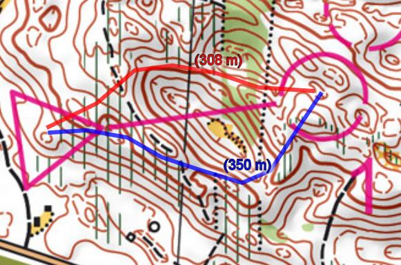
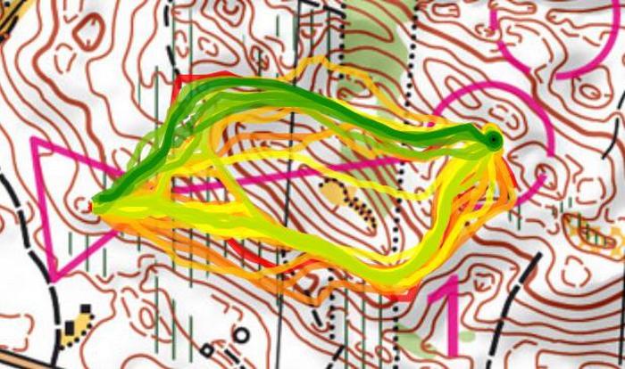
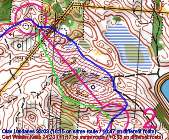
To the first control the best choise was clearly to go left which as you see on the routechoice statistics for both the men and women above. This was also the coursesetter Eva Jurenikova’s jugdement ahead of the event. One of the main reasons for so many runners choosing the rightmost route, is that the hill was very steep – and it was tempting to go right. I was out as a test runner in the morning, and even if I knew that left was supposed to be faster, I choose the rightmost option due to the tough hill.
One interesting point here: Both the European champions Lundanes and Niggli chose a non-optimal route. Lundanes went right and lost a few seconds. Niggli went direct(!) through the big depression – loosing nearly half a minute to Minna Kauppi!
Men 2-3 / Women 2-3
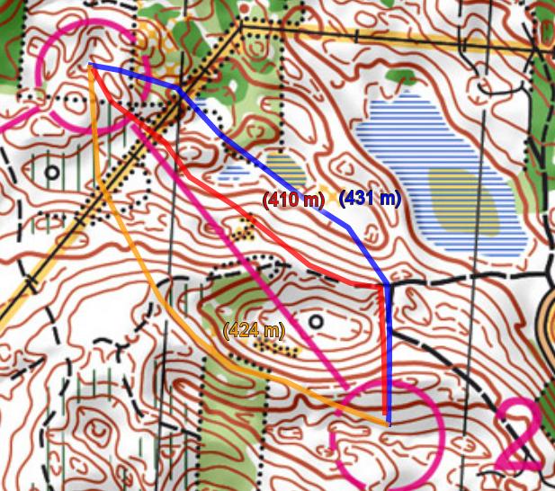
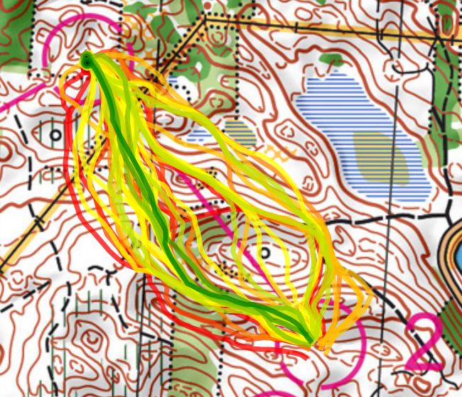
From 2 to 3 there were two main choices – either left saving some height or right using a path for part of the leg. The rightmost choice using the path was tempting for many as this reduces the technical difficulty of the leg somewhat. However, based on the routes run it looks like the majority of fast times are run on the left variant. You should, however, make the last half of the route as short as possible (many took a too wide curve).
Interestingly, Olav Lundanes took the “wrong” choice again – but run fast. All four top women took the left option.
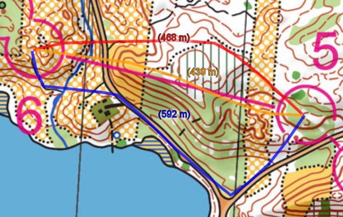
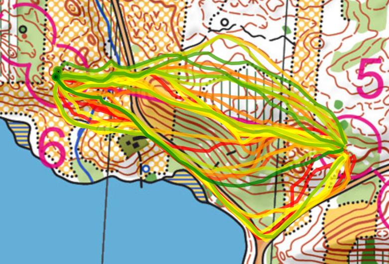
Men 5-6 / Women 5-6
The leg from 5 to 6 was the leg in the course which spread the runners most. However the different routechoices were very equal in running time. The course setters favourite was the northernmost choise – which Olav Lundanes choose. However the choice of Kratov (going south all the way on the road) was nearly just as fast.
Men 8-9
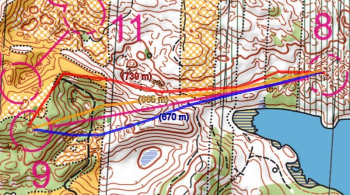
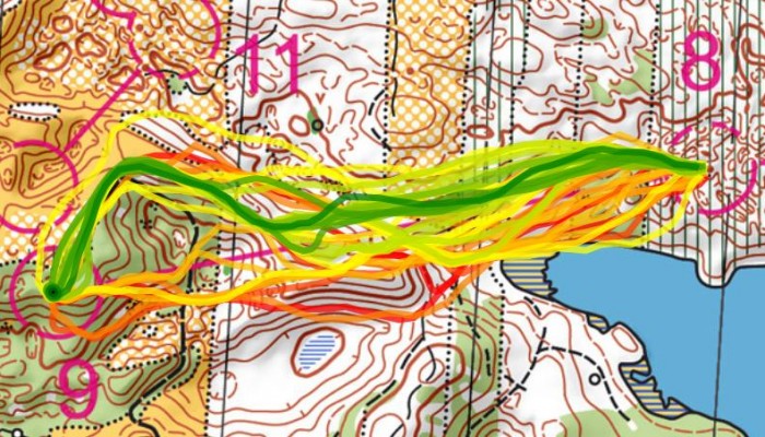
The leg from 8 to 9 was the longest leg in the mens class. The terrain did not invite to long routechoice-legs with very distinct routes – the “challenge” on this leg is the very last part of the leg. The left alternative is about 70 meters shorter – but you need to take a lot of extra, steep height. In addition you get more tricky control-taking by going left.
Based on the routes run – and also the course setters advice ahead of the race – the rightmost option were you go around the green area on the northern edge is the fastest.
Women 9-10
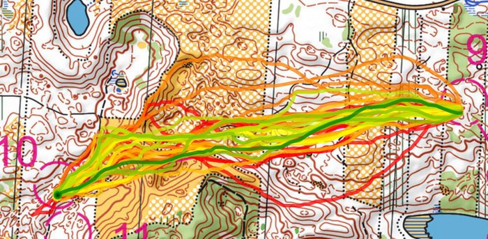
The women’s 9-10 waas not really a routechoice leg – a straight route was the only viable option. Still – typically of a middle distance – many runners lost time on the long leg due to the change in orienteering technique necessary. This was increased by the change in terrain characteristics
Men 12-13
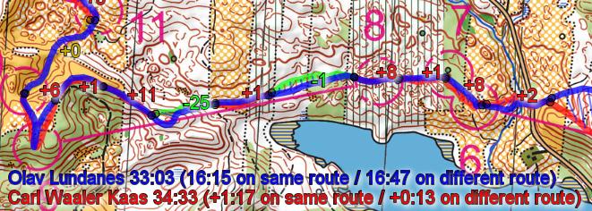
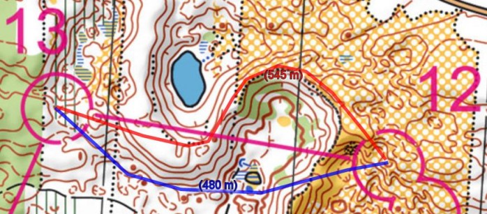
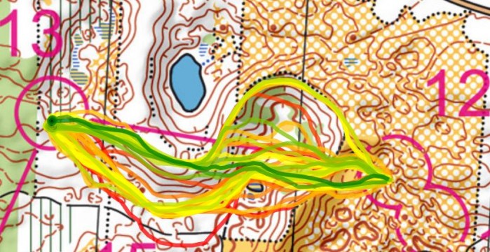
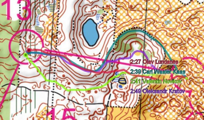
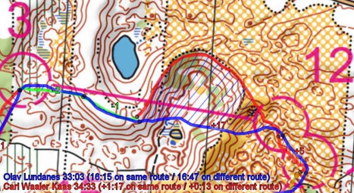
The men’s leg 12-13 was an interesting leg. As you can see above, the fastest times were run on straight variants (don’t trust the split times above as these are GPS split times). Lundanes took time on the others here – the other Top 4 runners spreading well on different route alternatives. The straight variants are 60 meters shorter with not much more ascent – does it is clearly too far to take e.g. Carl Waaler Kaas’s route around to the right.
Men 16-17 / Women 11-12
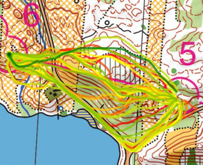
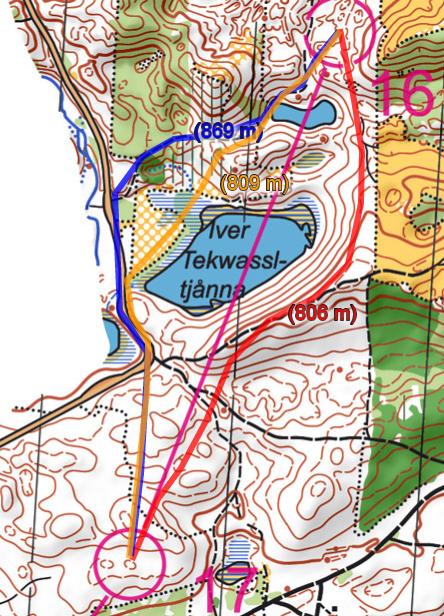
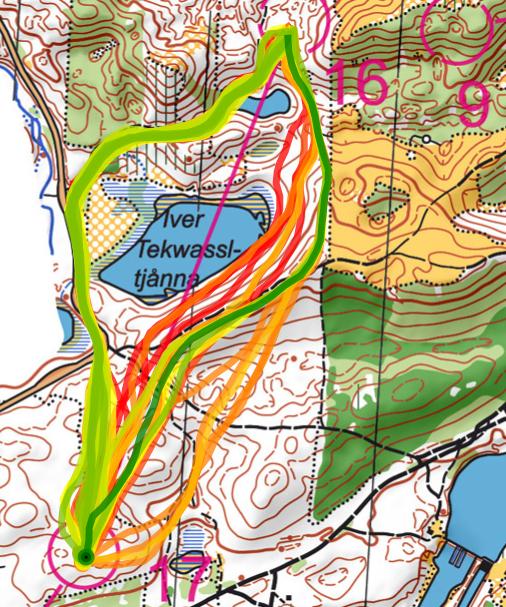
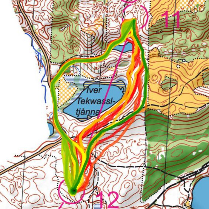
The leg from 16-17 for the men and the similar leg 11-12 for the women each had two distinct route choice alternatives: Either going right and using the big road and running a bit longer – or going left and taking more height while running shorter.
For both the men and the women, the left option up and down the hill has been run faster – however there is a big spread in running times for this route choice whereas runners running the rightmost routechoice have more consistently run good times. Based on this the rightmost choise around the road might very well be the best option.
Do more yourself
The above analysis is done in 2DRerun – and all the GPS material is available there for you to do more analysis:
