EOC 2012 GPS analysis: Warm up with training-analysis
In a cooperation with the EOC 2012 organizers, World of O/O-training.net will do GPS-analysis after each of the EOC races in Sweden the coming week. As a warm-up I have taken a brief look at some of the trainings in EOC-relevant terrain which have been uploaded to 3DRerun/2DRerun.
As running speed and focus has been different for the different runners, this analysis will more look at some examples from different EOC training maps than to look at a specific analysis. Still it can be good to take a look to see what kind of challenges the runners will meet in Sweden next week. You can also take a look at what the course setters say about the terrain and the challenges at the EOC webpage. - Those that ran pre-EOC and Elitserien at Bonäs in spring 2011 may be expecting similar, extremely fast pine heath terrain with sandy ridges. Sure, there are similarities with Bonäsheden but the terrain in Skattungbyn is more varied, many of the ridges are higher, the depressions deeper and the amount of detail greater.
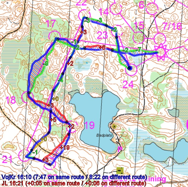
Sample 1 (a): Run straight lines
This sample is from a one-man relay training at Åmotjärn 2. Typical for this terrain is many small hills with some some open forest, some greener areas and some marshes. In many cases the fastest route is to stay as close to the line as possible – and in this example you can see how staying close to the line usually gives you an advantage of some seconds compared to making curves out. Open sample in 2DRerun.
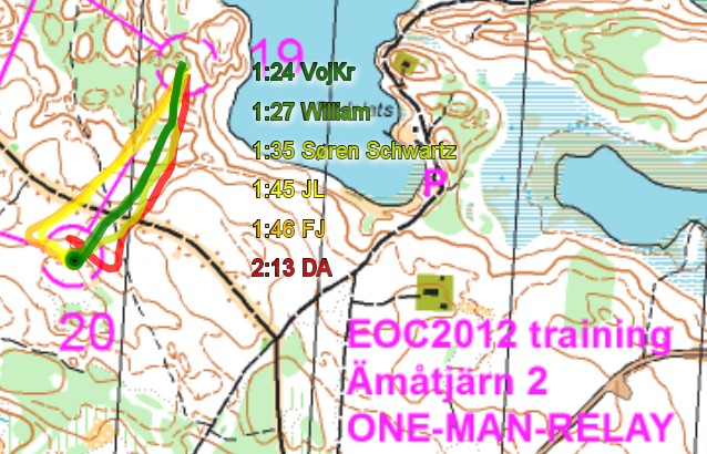
Sample 1 (b): Direction mistake – underestimating difficulties
Control number 20 above is one control were many runners did a direction mistakes. It is actually a quite easy control if you pay attention to direction and contours (to the left of the line) and the big path (the small path might be tricky to see?). The big path just ahead of the control makes you think the control is very easy – that is probably a reason for the many mistakes here. Open in 2DRerun.
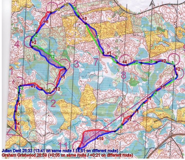
Sample 2: Run straight lines II
The second sample is from an EOC training on the map Vika. Compass and running straight is again important in this second example, even if the terrain characteristics are quite different. The example clearly again shows how all the small detours you take away from the line costs you a few seconds here and a few seconds there. The straight route choice is by no means the best choice for all legs in the EOC terrain – but in the cases where it is, you should use your compass and run straight. Open sample in 2DRerun here to take a closer look at it.
However: Don’t get fooled by the examples above – there may also be legs in this terrain-type where routechoices will be decisive! Both micro-routechoices and longer routechoices – so the straight line is not always the best approach – however make sure that you can run straight wherever it is necessary.
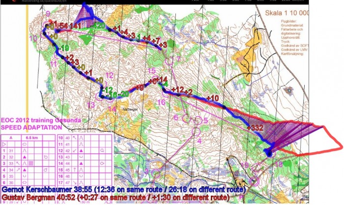
Sample 3: Speed adaption training, Gesunda
The third example is a speed adaption training in Gesunda – on a snowy day which you can read about on Gustav Bergman’s Doma-archive (Kerschbaumer was there the same day). Two of the worlds best orienteers who are among the favorites at the upcoming EOC - a bad day for both of them – they hopefully learned a lot before returning to the Falun-area next week! - A legendary bad performance. I don’t know what I shall say, is Bergman’s comment on his Doma-archive. The snow surely did not improve the concentration, but you should not fall asleep mentally on the long legs in this terrain. Also for the legs down the hills the tactics should be put on making the control easy to find. See example in 2DRerun here.


