Gradual reduced maps using crop objects
From O-training.net
Hubert Klauser (Talk | contribs)
(Created page with '1. Open map file in OCAD 11 Standard 2. Draw an area with hole that will be used as a crop mask File:CropMask.png 3. Select symbols that should be cropped [[File:CropSelect…')
Newer edit →
(Created page with '1. Open map file in OCAD 11 Standard 2. Draw an area with hole that will be used as a crop mask File:CropMask.png 3. Select symbols that should be cropped [[File:CropSelect…')
Newer edit →
Revision as of 16:14, 17 January 2014
1. Open map file in OCAD 11 Standard
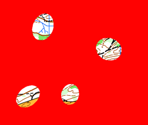
2. Draw an area with hole that will be used as a crop mask

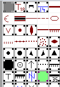
3. Select symbols that should be cropped

4. Choose crop function in Object menu
- Choose 'All objects from selected symbols'
- Choose selected cropping object (drawn area)
- Choose 'Cut a hole' option
Example: File:CropExampleGrobFein.png
Please Log in to contribute to O-training.net
O-training.net Blog articles:
- WOC Sprint Relay 2015: BIG GPS & Splits Analysis
- World Cup Long Spain: Quick GPS analysis
- WinSplits Pro for Iphone: Quick Review
- Gueorgiou: How to master the compass
- HeadCam analysis with local videos in 2DRerun
- What is effective technical training?
- RouteChoice Challenge: Long decisive leg in Swiss Champs Long
- WebRoute: Route choice leg Canada
- 2DRerun: Two very WOC Middle relevant races
- EOC Long Final: GPS Analysis
Useful links: