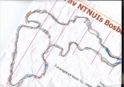
Corridor orienteering
From O-training.net
| (One intermediate revision not shown) | |||
| Line 1: | Line 1: | ||
{{Orienteering exercises | {{Orienteering exercises | ||
| - | |Exercise Types=Compass, Map reading, Flow | + | |Exercise Types=Compass, Map reading, Flow, GPS evaluation |
|Description=A corridor is drawn on the map, and the runner is to be inside the corridor at all times. The difficulty of the exercise can be adjusted by varying the width of the corridor, the terrain, the intensity etc. It is best to use GPS for evaluation of the exercise. | |Description=A corridor is drawn on the map, and the runner is to be inside the corridor at all times. The difficulty of the exercise can be adjusted by varying the width of the corridor, the terrain, the intensity etc. It is best to use GPS for evaluation of the exercise. | ||
|Aim=The aim of the exercise is to learn accurate map reading and learn to use features you are not used to in your orienteering. | |Aim=The aim of the exercise is to learn accurate map reading and learn to use features you are not used to in your orienteering. | ||
| Line 16: | Line 16: | ||
|Examples=http://omaps.worldofo.com/index.php?id=20353 http://omaps.worldofo.com/index.php?id=20279 http://omaps.worldofo.com/index.php?id=15542 http://omaps.worldofo.com/index.php?id=14082 | |Examples=http://omaps.worldofo.com/index.php?id=20353 http://omaps.worldofo.com/index.php?id=20279 http://omaps.worldofo.com/index.php?id=15542 http://omaps.worldofo.com/index.php?id=14082 | ||
}} | }} | ||
| + | http://omaps.worldofo.com/images/0195cda95cec8f322ec5a35965f782fc_l.jpg | ||
| + | http://omaps.worldofo.com/images/52a926e5fcf3f24f3d3bf254e18a98c9_l.jpg | ||
| + | http://omaps.worldofo.com/images/f037ab0c88a7011bb4f28af1f015bef3_l.jpg | ||
Current revision as of 21:30, 13 April 2010
Orienteering Exercise: Corridor orienteering
Key information
A corridor is drawn on the map, and the runner is to be inside the corridor at all times. The difficulty of the exercise can be adjusted by varying the width of the corridor, the terrain, the intensity etc. It is best to use GPS for evaluation of the exercise.
| Aim: | The aim of the exercise is to learn accurate map reading and learn to use features you are not used to in your orienteering. |
|---|---|
| Variants: | (a) Make a course in addition to the corridor. (b) The map inside the corridor may be e.g. contour only to make it more difficult. (c) Evaluation using GPS. May set up a competition for the training in how many times a runner is outside the corridor. (d) Use of controls in the terrain within/outside the corridor which the runner shall spot and decide if are inside/outside may make it more entertaining for the runner. (e) Can also be used on a street-o map. |
| Aids: | It is possible to make this exercise without OCAD (either by drawing with a black marker pen on the map or by using photoshop), but it is easiest to make this type of exercise using OCAD. See Tips_on_OCAD_usage for tips about how to make the exercise in OCAD. A GPS watch makes the evaluation of the training easier. |
| Terrain: | Any terrain will do - although there should be some details to orienteer on. |
| Preparations: | Draw corridor on map. The one who makes the exercise should either know the terrain quite well, or run through the corridor first. |
| Tips: | Adjust the difficulty to the ones running the training. Too difficult is no good. |
| Examples: | http://omaps.worldofo.com/index.php?id=20353 http://omaps.worldofo.com/index.php?id=20279 http://omaps.worldofo.com/index.php?id=15542 http://omaps.worldofo.com/index.php?id=14082 |


Please Log in to contribute to O-training.net
O-training.net Blog articles:
- WOC Sprint Relay 2015: BIG GPS & Splits Analysis
- World Cup Long Spain: Quick GPS analysis
- WinSplits Pro for Iphone: Quick Review
- Gueorgiou: How to master the compass
- HeadCam analysis with local videos in 2DRerun
- What is effective technical training?
- RouteChoice Challenge: Long decisive leg in Swiss Champs Long
- WebRoute: Route choice leg Canada
- 2DRerun: Two very WOC Middle relevant races
- EOC Long Final: GPS Analysis
Useful links:
